| CPC G08G 5/006 (2013.01) [B64C 39/024 (2013.01); B64D 47/08 (2013.01); G05D 1/0033 (2013.01); G05D 1/0061 (2013.01); G05D 1/0094 (2013.01); G05D 1/0274 (2013.01); G06T 5/002 (2013.01); G06V 20/64 (2022.01); G08G 5/0069 (2013.01); H04B 7/18506 (2013.01); B64U 2101/30 (2023.01); B64U 2201/10 (2023.01); B64U 2201/20 (2023.01); G01S 19/13 (2013.01); G06T 2207/10016 (2013.01); G06T 2207/10032 (2013.01); G06T 2207/20012 (2013.01); G06T 2207/30232 (2013.01); G06T 2207/30244 (2013.01); G06V 2201/10 (2022.01); H04W 4/021 (2013.01)] | 20 Claims |

|
1. A method, comprising:
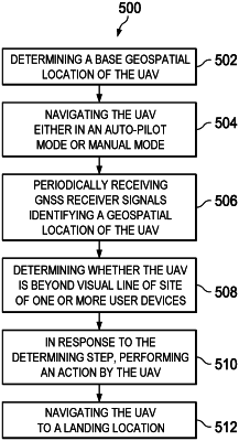
obtaining geospatial positional information of an unmanned aerial vehicle while the unmanned aerial vehicle navigates a flight path;
determining an impending loss of a visual line of sight between the unmanned aerial vehicle and a user device in communication with the unmanned aerial vehicle based on the geospatial positional information and a flight trajectory of the unmanned aerial vehicle; and
instructing the unmanned aerial vehicle to perform a flight maneuver to prevent the impending loss of the visual line of sight.
|