| CPC G01C 21/367 (2013.01) [G01C 21/3461 (2013.01); G01C 21/3484 (2013.01); G01C 21/3492 (2013.01); G08G 1/0145 (2013.01); G06F 16/23 (2019.01); H04W 4/021 (2013.01)] | 20 Claims |

|
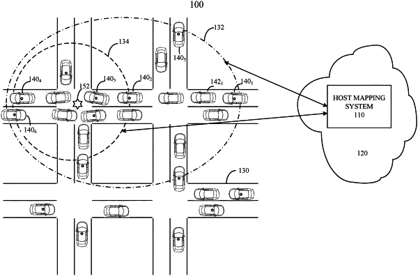
1. A host mapping system configured to update a region of a host map based on sensor data received from a plurality of connected vehicles travelling in the region, comprising:
a transceiver configured to receive location area signals from the plurality of connected vehicles travelling in the region; and
a computing processing unit (CPU) including processing circuitry configured to execute program instructions stored on a computer-readable medium, causing the processing circuitry to:
monitor vehicle traffic activity in the region based on the location area signals;
determine whether a discrepancy exists between the vehicle traffic activity and expected vehicle traffic activity based on the host map;
when no discrepancy exists, continue monitoring vehicle traffic activity;
when the discrepancy exists, determine a map area of the discrepancy;
surround the map area of the discrepancy with a first geo-fence;
request that each of the connected vehicles transmit first sensor data while travelling in the map area of the first geo-fence;
receive the first sensor data from each of the connected vehicles travelling in the map area of the first geo-fence;
compare the first sensor data of each of the connected vehicles to the first geo-fenced area of the map;
identify the discrepancy based on the first sensor data received from each of the connected vehicles;
update the host map; and
transmit the update to the plurality of connected vehicles travelling in the region.
|