| CPC G06V 20/17 (2022.01) | 11 Claims |

|
1. A method for processing photogrammetry data that represents parcels, the method comprising:
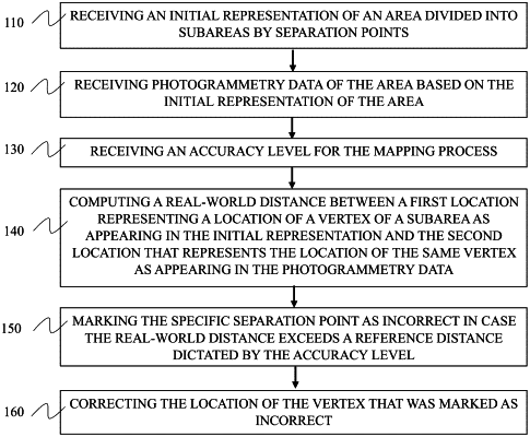
receiving an initial representation of an area divided into subareas by separation points;
receiving photogrammetry data of the area based on the initial representation of the area;
computing a real-world distance between a first location representing a location of a specific separation point of a specific subarea included in the area as appearing in the initial representation and a second location that represents a location of the same specific separation point as appearing in the photogrammetry data;
defining a specific separation point as incorrect in case the real-world distance exceeds a reference distance dictated by the accuracy level;
for each subarea of the subareas, examine one or more examined vertices:
identifying one or more intersecting subareas of the subarea to which the examined vertex belongs;
measuring a distance between the examined vertex and a closest point in the intersecting subarea;
marking the examined vertex as an error if the intersecting distance exceeds a threshold;
computing the azimuths or reference angles for all the edges defining boundaries of the subarea;
determining whether or not two subsequent edges have an angle between them that satisfies a condition representing that the subsequent edges constitute a single line;
removing a vertex between the two subsequent edges from a list of vertices that define the subarea.
|