| CPC G06T 11/60 (2013.01) [G06F 30/13 (2020.01); G06N 20/00 (2019.01); G06T 11/20 (2013.01)] | 20 Claims |

|
1. A computer-implemented method of creating an indoor map from a CAD drawing, the method comprising:
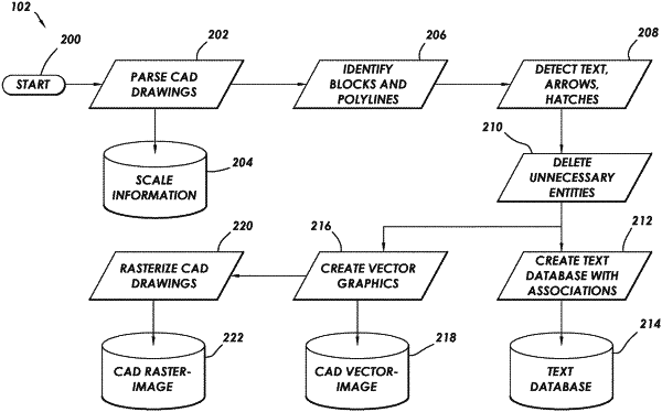
preprocessing, by a device, an original CAD drawing to create a modified CAD drawing, a text database containing text from the original CAD drawing, a CAD vector-image of the modified CAD drawing, and a CAD raster-image of the modified CAD drawing;
determining, by a device, a floor depicted in the CAD drawing, the determining results in a floor-level bounding line;
sensing, by a device, furniture depicted on the floor by applying the floor-level bounding line, the CAD vector-image, and the text database to machine-learning algorithms, the sensing results in a plurality of furniture entities and associated location information;
identifying, by a device, each room depicted in the CAD drawing within the floor-level bounding line, the identifying results in a plurality of room outlines; and
creating, by a device, an indoor map for the floor by combining the plurality of furniture entities and associated location information with the plurality of room outlines.
|