| CPC G01C 21/3614 (2013.01) [G01C 21/3492 (2013.01); G01C 21/3804 (2020.08)] | 19 Claims |

|
1. A method comprising:
receiving first vehicle metric data associated with a first vehicle, wherein the first vehicle metric data comprises first harsh event metric data, first speed data, and a first geographical coordinate;
receiving second vehicle metric data associated with a second vehicle, wherein the second vehicle metric data comprises second harsh event metric data, second speed data, and a second geographical coordinate;
determining first correlated data based at least on: the first vehicle metric data, the first geographical coordinate, the second vehicle metric data, and the second geographical coordinate, wherein determining the first correlated data comprises creating first combined data from at least: (i) the first harsh event metric data and the second harsh event metric data, or (ii) the first speed data and the second speed data;
determining second correlated data based at least: the first vehicle metric data, the first geographical coordinate, the second vehicle metric data, and the second geographical coordinate, wherein determining the second correlated data comprises creating second combined data from at least a different one of: (i) the first harsh event metric data and the second harsh event metric data, or (ii) the first speed data and the second speed data;
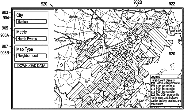
causing presentation of the first correlated data in an interactive graphical user interface, wherein the presentation of the first correlated data indicates (i) at least some of the first combined data being associated with a portion of a first geographical map and (ii) one of a harsh event or a speed, and wherein the portion of the first geographical map is a road segment or a neighborhood; and
in response to receiving, via the interactive graphical user interface, user input indicating a map type change selection, dynamically updating to cause presentation of third correlated data in the interactive graphical user interface, wherein the presentation of the third correlated data indicates (i) at least some of third combined data being associated with a portion of a second geographical map, wherein the portion of the second geographical map is a different one of the road segment or the neighborhood.
|