| CPC G08G 5/0069 (2013.01) [B64C 39/024 (2013.01); G08G 5/0013 (2013.01); G08G 5/006 (2013.01); B64U 2201/10 (2023.01)] | 17 Claims |

|
1. A method for controlling an aerial vehicle comprising:
receiving a data file indicating a flight restriction level and a range of an airport area in an airport, the flight restriction level of the airport area being determined based at least on a risk level of the airport, and the risk level of the airport being determined based at least on an airport traffic volume of the airport;
parsing the data file to obtain the flight restriction level and the range of the airport area; and
controlling the aerial vehicle to execute a flight restriction strategy according to the flight restriction level and the range of the airport area;
wherein:
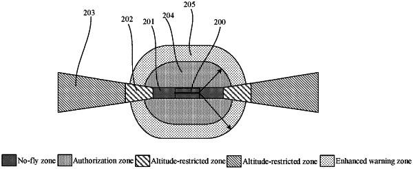
the airport area includes an airport runway and a runway extension;
the airport runway and the runway extension form a first area of the airport area;
the airport area further includes a second area, the second area including a trapezoidal area connected to an end of the first area and extending along an extension direction of the airport runway; and
the trapezoidal area is an isosceles-trapezoidal area with a midline parallel to the extension direction of the airport runway.
|