| CPC G06V 20/13 (2022.01) [G06F 18/2155 (2023.01); G06V 10/255 (2022.01); G06V 20/41 (2022.01)] | 19 Claims |

|
1. A method of performing collaborative geospatial tracking, comprising:
receiving, by a computing device, (i) live video from a first source and (ii) geotagged content from a second source;
providing a map that encompasses a geographical region imaged by the live video; and
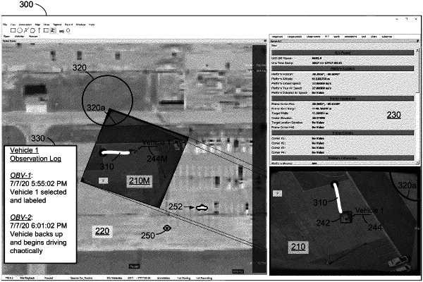
simultaneously displaying, by a software application of the computing device, the map, the live video, and a representation of the geotagged content from the second source,
wherein simultaneously displaying includes projecting a modified version of the live video onto the map, such that the computing device displays dynamic content of the live video overlaying static content of the map, and
wherein the method further comprises generating the modified version of the live video at least in part by:
removing a perspective effect in the live video, including aligning vertices of the live video with corresponding geographical points on the map; and
transforming the live video to fit within the geographical points on the map.
|