| CPC G08G 1/096775 (2013.01) [G08G 1/0112 (2013.01); G08G 1/0141 (2013.01); G08G 1/0145 (2013.01); G08G 1/0969 (2013.01); G08G 1/164 (2013.01); G08G 1/166 (2013.01)] | 6 Claims |

|
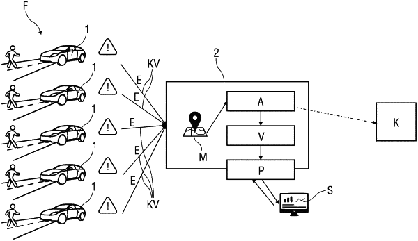
1. A method for identifying potential hazard zones in road traffic by vehicles connected to a central computer unit, the method comprising:
recording an incident indicative of a potential hazard zone and transmitting the recorded incident to the central computer unit with a geolocation of the incident, wherein the recorded incident is vegetation obscuring a pedestrian crossing;
listing the transmitted incident as a hotspot in a digital map if there are a large number of similar incidents with a same geolocation as the incident;
adding contextual information to the transmitted incident;
analyzing the hotspot to recognize a potential hazard zone;
comparing the hotspot with confirmed hotspots; and
depicting the hotspot and confirmed hotspots on a platform, wherein a geolocation of a hotspot of confirmed traffic-critical incidents is transmitted to an authority to be checked or as a warning message to a vehicle that is near the geolocation of the hotspot of the confirmed traffic-critical incidents,
wherein the geolocation of the hotspot is reported to a road authority.
|