| CPC B60W 60/001 (2020.02) [B60W 2552/00 (2020.02); B60W 2554/4029 (2020.02); B60W 2554/4042 (2020.02); B60W 2554/406 (2020.02)] | 18 Claims |

|
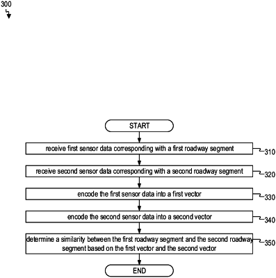
1. A computer-implemented method comprising:
receiving first sensor data corresponding with a first roadway segment;
receiving second sensor data corresponding with a second roadway segment;
encoding the first sensor data into a first vector, wherein the first vector represents a first roadway characteristic associated with the first roadway segment;
encoding the second sensor data into a second vector, wherein the second vector represents a second roadway characteristic associated with the second roadway segment; and
determining a similarity between the first roadway segment and the second roadway segment based on the first vector and the second vector by employing a vector manipulation; and
clustering the first vector and the second vector upon determining the similarity between the first roadway segment and the second roadway segment, wherein the clustered first and second vectors are searchable to facilitate identification of the first and second roadway characteristic.
|