| CPC G16B 20/20 (2019.02) [C12Q 1/6895 (2013.01); G01N 21/31 (2013.01); G01N 33/0098 (2013.01); G06V 20/188 (2022.01); A01G 7/00 (2013.01); C12Q 2600/13 (2013.01); C12Q 2600/158 (2013.01); G01N 21/6456 (2013.01); G01N 33/245 (2024.05); G06V 20/194 (2022.01)] | 27 Claims |

|
1. A computer-aided method for performing data analysis for plant phenotyping of one or more single plants in each of a plurality of distributed fields, comprising the steps of:
simultaneously capturing spectral data associated with the one or more single plants in each of the plurality of distributed fields via a hyperspectral imaging sensor;
simultaneously capturing image data associated with the one or more single plants in each of the plurality of distributed fields via an image sensor, wherein the image sensor is a color sensor for selective detection and evaluation of a visible spectral range;
simultaneously capturing high-resolution georeference data associated with the one or more single plants in each of the plurality of distributed fields via an inertial measurement unit comprising acceleration sensors and rotational speed sensors, the high-resolution georeference data comprising georeferenced coordinates;
transmitting the captured spectral data, image data, and high-resolution georeference data to one or more remote servers;
spatializing, via the one or more remote servers, the image data to generate georeferenced image data and a high-resolution digital surface model, wherein spatializing the image data comprises assigning spatial coordinates to the image data and spatially correcting the image data such that spatial information is assigned to individual image pixels, wherein the high-resolution digital surface model includes height information comprising an orientation of growth of a plant, a direction of growth of the plant, a direction of growth of leaves of the plant, a height of the plant, or combinations thereof, wherein generating the high-resolution digital surface model comprises:
obtaining multiple recordings of an individual picture element by capturing the image data; and
combining the multiple recorded picture elements in a three-dimensional image;
generating, via the one or more remote servers, one or more visual indications of diseased leaves, healthy leaves, soil, or combinations thereof from the spectral data by comparing the spectral data to referenced spectral data from a spectral database;
spatializing, via the one or more remote servers, the spectral data;
generating, via the one or more remote servers, georeferenced spectral data from the spatialized spectral data using the high-resolution digital surface model;
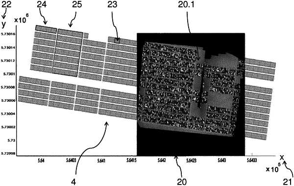
overlaying, via the one or more remote servers, the one or more visual indications, the georeferenced image data, and the georeferenced spectral data with field plan information to generate a high-resolution analysis data set by using a merging algorithm, wherein the overlaying of the georeferenced image data and the georeferenced spectral data with the field plan information comprises an assignment of field piece information according to the georeferenced coordinates; and
localizing, via the one or more remote servers, the one or more single plants in a range of 10 cm around one or more real positions of the one or more single plants in each of the plurality of distributed fields.
|