| CPC G01S 19/235 (2013.01) [G01S 19/24 (2013.01)] | 20 Claims |

|
1. A method comprising:
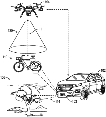
receiving, by an unmanned aerial vehicle (UAV), vehicle radar data and radar calibration data from a vehicle, as well as location information for a location of the vehicle;
determining a simulated UAV at the location of the vehicle;
establishing an orientation for a simulated radar on a bottom of the simulated UAV;
determining a height for the simulated UAV to match a field of view of the simulated radar;
for each radar event detected in the vehicle radar data, performing a geometrical transformation to convert the vehicle radar data set into a UAV perspective;
converting the vehicle radar data into a vehicle coordinate frame using the radar calibration data and vehicle global positioning system (GPS) coordinates;
converting the vehicle coordinate frame from a global frame into a UAV coordinate frame using UAV GPS coordinates; and
converting the UAV coordinate frame into a simulated radar sensor frame to generate a simulated bird's eye view of an environment around the vehicle.
|