| CPC G06T 17/05 (2013.01) [G01C 21/3815 (2020.08); G01C 21/3826 (2020.08); G01C 21/3867 (2020.08); G05D 1/0088 (2013.01); G06F 30/20 (2020.01); G06T 19/006 (2013.01)] | 20 Claims |

|
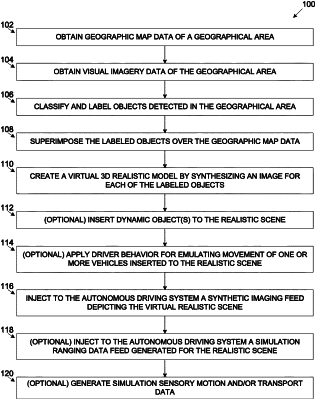
1. A system for creating a simulated virtual realistic model of a geographical area for training, evaluating or validating an autonomous driving system (ADS), comprising:
at least one processor adapted to execute code, the code comprising:
code instructions to obtain geographic map data of a geographical area;
code instructions to obtain visual imagery data of the geographical area;
code instructions to classify a plurality of static objects identified in the visual imagery data to corresponding labels to designate a plurality of labeled objects;
code instructions to superimpose the plurality of labeled objects over the geographic map data;
code instructions to generate a virtual three dimensional (3D) realistic ADS training model emulating the geographical area by synthesizing a corresponding visual texture for each of the plurality of labeled objects; and
code instructions to create the simulated virtual realistic model by inserting one or more dynamic objects to the virtual 3D realistic ADS training model; and
code instructions to apply movement of said one or more dynamic objects according to movement patterns predefined or learned for said geographical area.
|