| CPC G01V 1/308 (2013.01) [G01V 1/38 (2013.01); G01V 2210/1212 (2013.01); G01V 2210/612 (2013.01)] | 12 Claims |

|
1. A method of performing a marine seismic 4D monitor survey that repeats a previous survey, comprising:
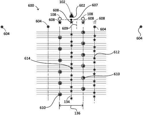
towing a number of sources during the marine seismic 4D monitor survey that is greater than a number of sources that were used to perform the previous survey, such that the marine seismic 4D monitor survey employs additional sources relative to the number of sources that were used to perform the previous survey; and
activating the additional sources during the marine seismic 4D monitor survey to produce additional shot points relative to shot points that were produced during the previous survey;
wherein crossline outermost sources that were used to perform the previous survey define a previous survey crossline source spread; and
wherein some of the additional shot points are produced at crossline positions outside the previous survey crossline source spread and others of the additional shot points are produced at crossline positions inside the previous survey crossline source spread.
|