| CPC G01V 1/282 (2013.01) [G01V 1/301 (2013.01); G01V 2210/1234 (2013.01)] | 7 Claims |

|
1. A method for determining a location of hydrocarbon reservoirs using a created mechanical properties model of a subsurface geological area, the method comprising the following steps executed by a computer:
receiving gamma rays data, sonic data or measured density data measured in well logs in the subsurface geological area;
deriving tectonic time data and tectonic pressure data using a seismic interpretation of the subsurface geological area and the data from well log measurements;
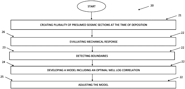
generating a plurality of presumed seismic sections at time of deposition based on the seismic interpretation of the subsurface geological area and of the derived tectonic time data and tectonic pressure data;
detecting boundaries in the plurality of presumed seismic sections at the time of deposition using the received gamma rays data, sonic data or measured density data;
creating a mechanical properties model of the subsurface geological area based on the plurality of presumed seismic sections at the time of deposition and the influences of tectonic time data and tectonic pressure data; and the detected boundaries in the plurality of presumed seismic sections at the time of deposition;
analyzing the mechanical properties model of the subsurface geological area to determine presence and position of progradational surfaces in the subsurface geological area; and
determining, by a determining device, the location of the hydrocarbon reservoir in the subsurface geological area using the position of the progradational surfaces.
|