| CPC G01N 33/24 (2013.01) [G01N 15/0227 (2013.01)] | 20 Claims |

|
1. A method of mine material tracking comprising:
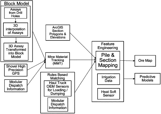
receiving, by one or more processors, data, wherein the data comprises terrain data, haul truck sensor data, block model data and dispatch data and at least one of load point data, shovel high-precision global positioning system (HPGPS) data for a shovel, provision data or mine system data;
receiving, by the one or more processors, chemical data and mineralogical data of ore at a plurality of blast holes;
interpolating, by the one or more processors, the plurality of blast holes in the block model data;
assigning, by the one or more processors, the plurality of blast holes to a geographic location post-blast;
merging, by the one or more processors, the geographic location post-blast, the dispatch data, the terrain data and the haul truck sensor data with the block model data;
linking, by the one or more processors, the block model data to a truck load based on the merging;
aggregating, by the one or more processors, ore characteristics for the truck load;
capturing, by the one or more processors, images of ore that is placed in the truck load to determine particle size distribution information about the ore;
determining, by the one or more processors, a location of the ore in a stockpile; and
transmitting, by the one or more processors, to the shovel an instruction signal about the location of the ore in the stockpile having optimal of the ore characteristics to obtain metals from the ore,
wherein the shovel obtains at least a portion of the ore from the location of the ore in the stockpile, in response to the instruction signal.
|