| CPC G01C 21/3682 (2013.01) [G01C 21/3438 (2013.01); G01C 21/3476 (2013.01); G01C 21/3661 (2013.01); G06N 20/00 (2019.01)] | 17 Claims |

|
1. A method comprising:
generating, by a computing system, a height parameter database by correlating derived height parameters with different levels of multilevel roadways for a plurality of points of interest;
receiving, at the computing system from a computing device over a network, a request that includes a point of interest associated with a multilevel roadway;
in response to receiving the request, performing, by the computing system in real time, operations comprising:
accessing device data from the computing device, the device data including a sensor reading from a sensor of the computing device at the point of interest;
analyzing the sensor reading to derive a height parameter associated with the computing device;
using the derived height parameter and the height parameter database, identifying a level of the multilevel roadway at the point of interest where the computing device is located;
generating and causing presentation of a route including the point of interest using the identified level of the multilevel roadway; and
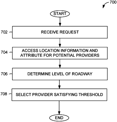
determining a service provider to provide a transportation service associated with the request, the determining comprising:
receiving location information including a detected attribute from devices of a plurality of potential service providers;
using the location information and detected attribute from the devices of the plurality of potential service providers, determining a height parameter associated with each of the plurality of potential service providers, the height parameter indicating a level of roadway each of the potential service providers are located; and
using the level of the roadway, selecting a service provider from the plurality of potential service providers that satisfies a predetermined threshold associated with the point of interest;
continuously aggregating, by the computing system, new trip data while monitoring the computing device as the computing device traverses the route; and
continuously updating, by the computing system. the height parameter database based on an analysis of the new trip data.
|