| CPC G01C 15/04 (2013.01) [G01C 11/02 (2013.01); G01S 17/89 (2013.01); G01S 19/485 (2020.05); G06T 7/70 (2017.01); G06V 20/17 (2022.01); G01S 19/10 (2013.01); G01S 19/45 (2013.01)] | 12 Claims |

|
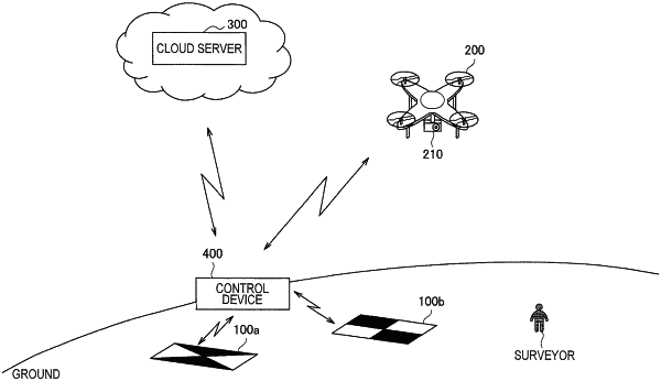
1. A survey marker, comprising:
a global navigation satellite system (GNSS) receiver that receives a signal from a GNSS satellite; and
the survey marker has a predetermined shape and including at least two areas with different properties from one another, wherein
the at least two areas have a different reflectivity from one another,
a ground position of the survey marker is measured by the signals received on the GNSS receiver,
the survey marker is detectable based on the different properties of the at least two areas,
a position of the survey marker, in an image that includes the survey marker, is associated with the ground position,
the at least two areas include a first area and a second area,
the predetermined shape further includes a third area and a fourth area,
the third area has a same reflectivity as the first area,
the fourth area has a same reflectivity as the second area,
the first area, the second area, the third area and the fourth area each has a quadrangle shape,
the first area borders the second area and the fourth area, and
the third area borders the second area and the fourth area.
|