| CPC G01C 13/008 (2013.01) [G01C 11/02 (2013.01); G06T 7/62 (2017.01); G06T 2207/10028 (2013.01); G06T 2207/10032 (2013.01)] | 14 Claims |

|
1. A system for measuring water capacity of polar lakes, comprising:
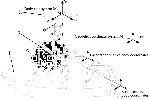
a) an unmanned underwater vehicle, an unmanned underwater vehicle-mounted module, an unmanned aerial vehicle, an unmanned aerial vehicle-mounted module and a ground operation module, wherein the unmanned underwater vehicle is used for carrying the unmanned underwater vehicle-mounted module;
b) the unmanned underwater vehicle-mounted module is connected with the unmanned aerial vehicle-mounted module and the ground operation module;
c) the unmanned underwater vehicle-mounted module configured to measure under-lake point cloud data and under-lake single-beam ranging data;
d) the unmanned aerial vehicle configured to carry the unmanned aerial vehicle-mounted module;
e) the unmanned aerial vehicle-mounted module is further connected with the ground operation module;
f) the ground operation module is further connected with the unmanned aerial vehicle and the unmanned underwater vehicle;
g) the ground operation module is configured to acquire a planned path of the unmanned underwater vehicle and control the unmanned underwater vehicle to move along with the unmanned underwater vehicle at a preset height right above the unmanned underwater vehicle by utilizing an active disturbance rejection control (ADRC) algorithm;
h) the unmanned aerial vehicle-mounted module configured to:
i. acquire lake surface point cloud data and attitude data of the unmanned aerial vehicle-mounted module; and
ii. determine coordinate system conversion parameters of the unmanned underwater vehicle and the unmanned aerial vehicle according to the attitude data of the unmanned aerial vehicle-mounted module;
i) the ground operation module configured to:
i. determine the lake surface point cloud data under the geographic coordinate system, the under-lake point cloud data under the geographic coordinate system and the under-lake single-beam ranging data under the geographic coordinate system according to the coordinate system conversion parameters
ii. construct a water three-dimensional topographic map according to the lake surface point cloud data under the geographic coordinate system,
iii. construct a lake coastal three-dimensional topographic map according to the under-lake point cloud data under the geographic coordinate system;
iv. construct a lake bottom three-dimensional topographic map according to the under-lake single-beam ranging data under the geographic coordinate system; and
v. determine the lake water capacity based on the water three-dimensional topographic map, the lake coastal three-dimensional topographic map and the lake bottom three-dimensional topographic map.
|