| CPC G06T 7/60 (2013.01) [G06T 7/33 (2017.01); G06T 7/55 (2017.01); G06T 2207/10032 (2013.01); G06T 2207/30184 (2013.01)] | 32 Claims |
|
1. A method of computing a height of a structure, said method comprising:
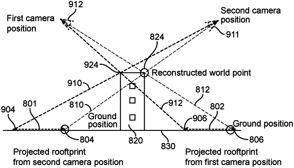
inputting a pair of first and second two-dimensional (2-D) aerial images taken from a camera from different perspectives along with metadata for each image, each image including at least said structure;
for each image, computing, using said metadata, a three-dimensional (3-D) vector from a geo-referenced location of said each image on a ground plane of the Earth toward the location of said camera when said each image was taken with said camera;
computing a plurality of pairs of coordinates of corresponding first and second image points from said geo-referenced locations of said images, wherein in each pair of image points a first image point of said first image identifies the same physical point on said structure as a second image point of said second image;
for each pair of image points, determining the intersection of said 3-D vector of said first image originating at the coordinates of said first image point with said 3-D vector of said second image originating at the coordinates of said second image point, wherein said each intersection being a 3-D position; and
determining said height by taking a median of said 3-D positions and outputting said height of said structure based upon said 3-D positions.
|