| CPC G06F 3/0482 (2013.01) [G06F 40/30 (2020.01); G06T 11/206 (2013.01); G06F 3/04847 (2013.01); G06T 2200/24 (2013.01)] | 20 Claims |
|
1. A method of visual analysis of datasets, comprising:
at a computing system having one or more processors and memory storing one or more programs configured for execution by the one or more processors:
receiving user selection of a data source;
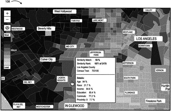
presenting a graphical user interface for analysis of data in the data source, wherein the data includes geospatial data points;
presenting a map data visualization within the graphical user interface, wherein the map data visualization includes a plurality of geographic regions, each geographic region corresponding to a respective one or more geospatial data points; and
in response to receiving a first user input to select a first set of one or more geographic regions of the plurality of geographic regions:
calculating a similarity between the first set of one or more geographic regions and a second set of one or more geographic regions of the plurality of geographic regions, based on a set of data fields from the data source, using one or more statistical techniques; and
updating and displaying the map data visualization according to the calculated similarity.
|