| CPC G01S 7/497 (2013.01) [G01S 7/4817 (2013.01); G01S 17/894 (2020.01); G05D 1/0291 (2013.01); G08G 1/22 (2013.01); B60W 50/06 (2013.01); B60W 60/001 (2020.02); B60W 2420/403 (2013.01); B60W 2420/408 (2024.01)] | 20 Claims |

|
1. A method comprising:
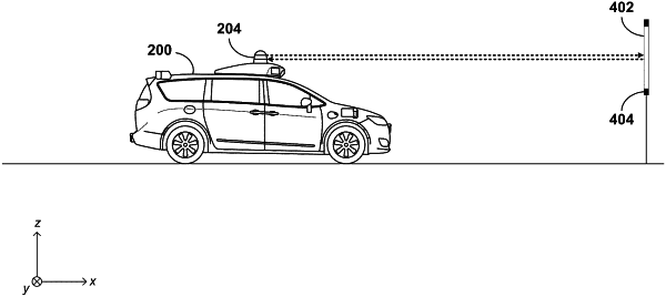
generating a point cloud of a region based on data from a light detection and ranging (lidar) device, wherein the point cloud includes points representing at least a portion of a calibration target;
determining a presumed location of the calibration target;
identifying, within the point cloud, a location of a first edge of the calibration target;
performing a comparison between the identified location of the first edge of the calibration target and a hypothetical location of the first edge of the calibration target within the point cloud if the calibration target were positioned at the presumed location;
revising the presumed location of the calibration target based on at least the comparison; and
transmitting the revised presumed location of the calibration target to a fleet management server.
|