| CPC G01C 3/02 (2013.01) [G01B 5/008 (2013.01); G01B 11/005 (2013.01); G01C 21/1656 (2020.08); G01S 17/06 (2013.01); G06T 7/70 (2017.01); G06T 2200/04 (2013.01); G06T 2207/10028 (2013.01)] | 21 Claims |

|
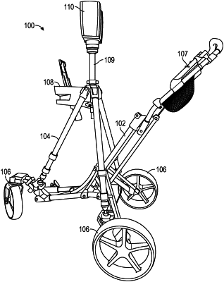
1. A system for measuring three-dimensional (3D) coordinate values of an environment, the system comprising:
a movable base unit;
a first scanner removably coupled to the base unit, the first scanner having a at least one sensor and a controller, wherein the at least one sensor and the controller cooperate to perform three-dimensional measurements;
a second scanner coupled to the base unit, the second scanner operable to selectively measure 3D coordinates of surfaces in the environment, the second scanner having a rotary mirror arranged to reflect an emitted second beam of light and a second reflected light; and
one or more processors operably coupled to the base unit, the first scanner and the second scanner, the one or more processors being responsive to nontransitory executable instructions for performing a method comprising:
causing the first scanner to determine first plurality of coordinate values in a first frame of reference based at least in part on measurements by the at least one sensor;
causing the second scanner to determining a second plurality of 3D coordinate values in a second frame of reference as the base unit is moved from a first position to a second position, the determining of the first coordinate values and the second plurality of 3D coordinate values being performed simultaneously; and
registering the second plurality of 3D coordinate values a common frame of reference based at least in part on the first plurality of coordinate values.
|