| CPC G05D 1/1064 (2019.05) [B64C 39/024 (2013.01); B64D 17/80 (2013.01); B64D 45/00 (2013.01); B64D 47/08 (2013.01); G01V 20/00 (2024.01); G05D 1/0094 (2013.01); G05D 1/106 (2019.05); G06F 16/5866 (2019.01); B64D 2201/00 (2013.01); B64U 2101/30 (2023.01); G06F 3/04817 (2013.01); G06T 7/70 (2017.01); G06T 2207/10032 (2013.01)] | 19 Claims |

|
1. An unmanned aerial vehicle, comprising:
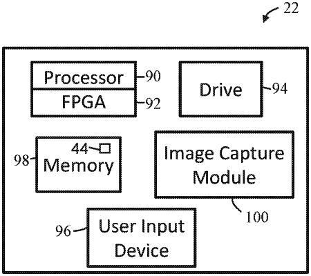
an image capture device; and
a controller programmed or hardwired to control fields of view of the image capture device during flight of the unmanned aerial vehicle such that items outside of boundaries surrounding a geographic area are not captured in any of one or more images captured by the image capture device during the flight, by:
determining a flight plan of the unmanned aerial vehicle, the flight plan configured such that the unmanned aerial vehicle and fields of view of the image capture device are restricted to the geographic area within the boundaries;
executing the flight plan;
orientating the image capture device by utilizing data about a geometric shape of the boundaries and data from attitude sensors to restrict the fields of view of the image capture device, thereby avoiding capturing images of areas outside of the boundaries while the unmanned aerial vehicle is flying the flight plan within the boundaries, and utilizing data about a structure within the geographic area within the boundaries, to ensure that the image capture device is oriented such that only the structure is in a frame of the one or more images taken by the image capture device when capturing the one or more images; and
capturing, with the image capture device, the one or more images while executing the flight plan, the one or more images restricted to fields of view within the boundaries of the geographic area, such that items outside of the boundaries are not captured in any of the one or more images, the one or more images comprising a first image and a second image each depicting areas less than a total of the geographic area within the boundaries.
|