| CPC G01V 3/20 (2013.01) [E21B 49/00 (2013.01); G01C 11/00 (2013.01); G01C 15/002 (2013.01)] | 20 Claims |

|
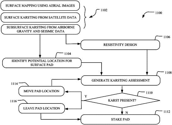
1. A method for obstacle avoidance in a subterranean formation in connection with a drilling operation, the method comprising:
receiving a data set for an area of interest of the subterranean formation from at least one of one or more light detection and ranging (LiDAR) systems, one or more satellite imagery systems, one or more air-borne gravity systems, or one or more three-dimensional seismic systems;
identifying a potential surface pad location for the area of interest using the data set, the potential surface pad location including a surface hole for a wellbore;
generating a survey for the potential surface pad location based on the data set;
determining, using the survey for the potential surface pad location, whether one or more obstacles are present in the subterranean formation disposed relative to the potential surface pad location; and
adjusting the potential surface pad location when the one or more obstacles are present in the subterranean formation disposed relative to the potential surface pad location.
|