| CPC G01C 21/3859 (2020.08) | 9 Claims |
|
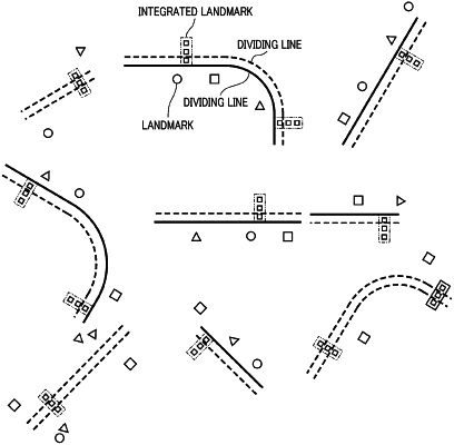
1. A method for generating a map comprising:
acquiring a plurality of segments, each of which includes a dividing line and a plurality of landmarks on a road;
setting at least one common landmark that is common among the landmarks of the segments that are acquired using a common landmark setting;
setting a dividing line in each of the segments using the at least one common landmark that is set by the common landmark setting;
identifying the dividing line in each of the segments as a dividing line on a map to generate map data; and
correcting an orientation of each of the segments in accordance with a position of the at least one common landmark set by the common landmark setting,
wherein the common landmark setting sets a plurality of common landmarks as the at least one common landmark, and
wherein correcting of the orientation of each of the segments comprises:
calculating a center point of gravity of each of the common landmarks to approximate the center point of gravity of each of the common landmarks on a plane;
calculating a normal vector for the center point of gravity of each of the common landmarks with respect to the plane;
calculating an average of the center points of gravity as an average center point of gravity;
calculating an average of the normal vectors as an average normal vector;
translating each of the segments with respect to the average center point of gravity;
rotating each of the segments with respect to the average normal vector; and
correcting the orientation of each of the segments by rotating each of the segments around the average normal vector in such a manner that a sum of squares of an error of each of the common landmarks is minimized, wherein
the map data is distributed to an in-vehicle device of a vehicle, and
the in-vehicle device controls the vehicle using the map data.
|