| CPC B63B 49/00 (2013.01) [B60L 8/003 (2013.01); B60L 2240/70 (2013.01); B63B 35/00 (2013.01); B63B 2035/008 (2013.01); B63G 2008/004 (2013.01); G05D 1/0206 (2013.01)] | 8 Claims |

|
1. A method of collecting meteorological data from an open water environment, the method comprising:
positioning a plurality of unmanned surface vehicles (USVs) in the open water environment, wherein each of the USVs comprises:
a buoyant hull structure configured to resist ultraviolet (UV) radiation and comprising:
an aluminum frame; and
an ethylene vinyl acetate (EVA) foam skin surrounding the aluminum frame;
a master computer unit (MCU) coupled to the buoyant hull structure;
a very high frequency (VHF) radio coupled to the buoyant hull structure;
a satellite radio coupled to the buoyant hull structure;
Global Positioning System (GPS) coupled to the buoyant hull structure;
a plurality of weather sensors coupled to the buoyant hull structure;
a navigation and propulsion controller coupled to the buoyant hull structure;
at least one thruster coupled to the buoyant hull structure and configured to provide propulsion;
a battery coupled to the buoyant hull structure;
a charge controller coupled to the buoyant hull structure; and
a solar panel coupled to the buoyant hull structure and configured to charge the battery;
collecting the meteorological data with the USVs;
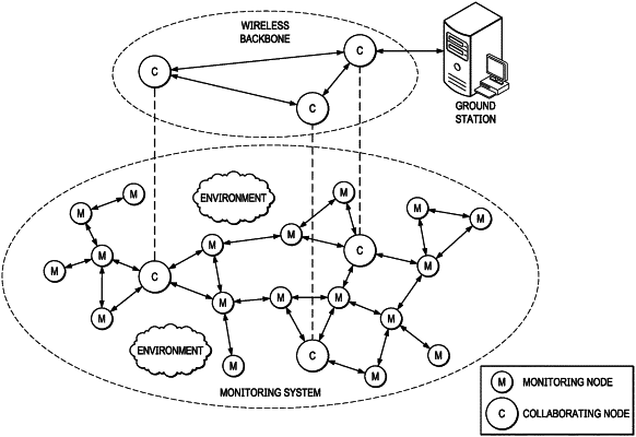
sending the meteorological data to a base station via a meshed communication network for analysis;
determining a needed sampling-region coverage and an ideal spatial resolution; and
updating a sensor location grid of the USVs based on the needed sampling-region coverage to obtain the ideal spatial resolution.
|