| CPC G06T 11/60 (2013.01) [G06F 3/011 (2013.01); G06T 5/006 (2013.01); G06T 11/001 (2013.01)] | 18 Claims |
|
1. A method comprising:
establishing a virtual boundary for a virtual-world environment in reference to a real- world environment;
determining whether the virtual boundary requires a correction;
in response to determining that the virtual boundary requires the correction, providing an alert;
in response to the alert, receiving a request from a user to modify the virtual boundary;
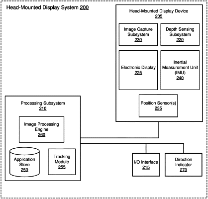
in response to the request from the user, monitoring an orientation of a direction indicator to generate orientation data, wherein the orientation data includes elevation data of an elevation of the direction indicator with respect to a reference elevation representing a plane of the real-world environment; and
modifying the virtual boundary based on the orientation data by determining an intersection between the plane and a virtual line that extends from the direction indicator at the elevation indicated by the elevation data and at the orientation indicated by the orientation data.
|