| CPC G06T 7/0012 (2013.01) [A01G 7/00 (2013.01); G01N 33/0098 (2013.01); G06V 20/188 (2022.01); G06T 2200/24 (2013.01); G06T 2207/10021 (2013.01); G06T 2207/10036 (2013.01)] | 30 Claims |

|
1. An apparatus comprising:
at least one processor configured to:
obtain an image capturing at least part of a growing area;
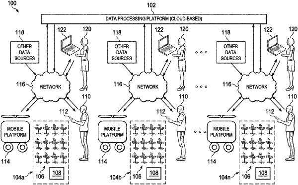
obtain stereo-spatio-temporal data measurements of plants in the growing area, the stereo-spatio-temporal data measurements comprising (i) first spatio-temporal data measurements of the plants in the growing area and (ii) second spatio-temporal data measurements of the plants in the growing area;
analyze the stereo-spatio-temporal data measurements to identify one or more actual or potential pests or diseases associated with one or more of the plants; and
generate a graphical user interface identifying at least one of the one or more actual or potential pests or diseases with the one or more plants;
wherein the first and second spatio-temporal data measurements of each stereo-spatio- temporal data measurement are associated with at least one common plant characteristic and different three-dimensional positions within the growing area taken at one or more known times;
wherein at least some of the first and second spatio-temporal data measurements comprise data measurements simultaneously captured at different heights by (i) at least one first sensor fixedly mounted on a base of a mobile platform and (ii) at least one second sensor mounted on a platform of the mobile platform that is movable relative to the base and used to identify the one or more actual or potential pests or diseases associated with one or more of the plants; and
wherein the graphical user interface comprises:
the image;
at least one indicator identifying the at least one of the one or more actual or potential pests or diseases, each indicator placed in the image in association with the associated plant that has or may have the associated actual or potential pest or disease; and
a summary section displayed adjacent to the image and providing details related to the at least one indicator identifying the at least one of the one or more actual or potential pests or diseases.
|