| CPC G01L 27/005 (2013.01) [H04W 4/025 (2013.01); H04W 4/38 (2018.02); H04W 4/90 (2018.02)] | 18 Claims |
|
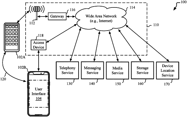
1. An electronic device comprising:
one or more memory devices to store instructions; and
one or more processors to execute the instructions, wherein the instructions are associated with an operating system executed by the one or more processors of the electronic device and the instructions cause the one or more processors to:
detect an interaction with an application configured to provide a navigation session;
determine a baseline barometric pressure in response to at least one calibration signal that indicates a probability that the electronic device is outdoors and at ground level, wherein the at least one calibration signal comprises the detected interaction with the application;
determine, by a location subsystem of the operating system, geographic coordinates for a first location;
determine, via the location subsystem, an altitude estimate for the first location;
determine, via the location subsystem, geographic coordinates for a second location;
determine, via the location subsystem, an altitude estimate for the second location, wherein to determine the altitude estimate for the first location and the second location comprises a comparison of a barometric pressure at a location with the baseline barometric pressure;
disambiguate the first location from the second location based on altitude estimates for the first location and the second location in response to an observed location history of the first location and the second location; and
store the first location and the second location as separate locations within a location database of the location subsystem, the location database stored in the one or more memory devices.
|