| CPC G01C 21/3685 (2013.01) [G01C 21/3407 (2013.01); G01C 21/3492 (2013.01); G01C 21/3676 (2013.01); G01C 21/3867 (2020.08); G08G 1/143 (2013.01)] | 20 Claims |
|
19. A non-transitory computer program product comprising instructions which, when executed by one or more processors of a navigation device, cause the navigation device to perform a method of determining a parking route for a vehicle travelling on a road network within a geographic area, wherein at least some roads of the road network have at least one parking space associated therewith, the road network being represented by an electronic map comprising a plurality of segments representing the roads of the road network, each segment having one or more attributes associated therewith including a length attribute indicative of a length of the segment, and wherein at least segments representing roads having at least one parking space have a probability attribute indicative of a probability of there being a vacant parking space on those segments, the method comprising:
obtaining a destination location within the geographic area;
generating a sub-network that includes a subset of segments of the electronic map by:
defining a reachability area proximal to the destination location, the defining including following each of one or more paths away from the destination location until a predetermined walking time or distance has been reached for that path and
adding an area associated with that path to the reachability area, wherein following the one or more paths includes following road segments that can be traversed by vehicles and pedestrians and pedestrian segments that can only be traversed by pedestrians; and adding, to the sub-network, specified segments in an area associated with each of the one or more paths, wherein the specified segments include only road segments;
associating, at least for the segments of the sub-network representing roads having at least one associated parking space, data indicative of a walking time or distance from the segment to the destination location;
exploring, using a search algorithm having an associated cost function, the segments of the sub-network from an origin location to identify a plurality of candidate parking routes, wherein each candidate parking route comprises a path of connected segments of the sub-network, said exploring comprising determining a cost for each of the plurality of candidate parking routes according to the cost function using the length attribute and probability attribute of each segment of the parking route, wherein the cost for a given parking route is based on a probability of the vehicle successfully finding a vacant parking space among the parking spaces associated with segments of the parking route and an expected cumulative travel and walking time or distance to the destination location should a vacant parking space be found along the parking route, the cumulative travel and walking time or distance comprising a sum of the travel time or distance to the vacant parking space and the walking time or distance from the vacant parking space to the destination location;
selecting one or more of the candidate parking routes for output based on the determined costs; and
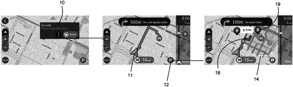
displaying a visual representation of some or all of the one or more parking routes on a display, the visual representation including each of the some or all of the one or more parking routes superposed on respective segments of the electronic map.
|