US 12,033,221 B2
Insurance underwriting and re-underwriting implementing unmanned aerial vehicles (UAVs)
Nathan L. Tofte, Downs, IL (US); Timothy W. Ryan, Hudson, IL (US); Nathan W. Baumann, Bloomington, IL (US); Joshua David Lillie, Bloomington, IL (US); Brian N. Harvey, Bloomington, IL (US); Roxane Lyons, Chenoa, IL (US); Rosemarie Geier Grant, Ellsworth, IL (US); and Michael Shawn Jacob, Le Roy, IL (US)
Assigned to STATE FARM MUTUAL AUTOMOBILE INSURANCE COMPANY, Bloomington, IL (US)
Filed by STATE FARM MUTUAL AUTOMOBILE INSURANCE COMPANY, Bloomington, IL (US)
Filed on Jun. 7, 2023, as Appl. No. 18/206,889.
Application 18/206,889 is a continuation of application No. 17/723,900, filed on Apr. 19, 2022, granted, now 11,710,191.
Application 17/723,900 is a continuation of application No. 16/838,372, filed on Apr. 2, 2020, granted, now 11,334,953, issued on May 17, 2022.
Application 16/838,372 is a continuation of application No. 16/509,631, filed on Jul. 12, 2019, granted, now 10,650,469.
Application 16/509,631 is a continuation of application No. 14/858,075, filed on Sep. 18, 2015, granted, now 10,410,289, issued on Sep. 10, 2019.
Claims priority of provisional application 62/209,963, filed on Aug. 26, 2015.
Claims priority of provisional application 62/209,755, filed on Aug. 25, 2015.
Claims priority of provisional application 62/209,627, filed on Aug. 25, 2015.
Claims priority of provisional application 62/208,201, filed on Aug. 21, 2015.
Claims priority of provisional application 62/207,421, filed on Aug. 20, 2015.
Claims priority of provisional application 62/207,127, filed on Aug. 19, 2015.
Claims priority of provisional application 62/053,519, filed on Sep. 22, 2014.
Prior Publication US 2023/0325935 A1, Oct. 12, 2023
This patent is subject to a terminal disclaimer.
Int. Cl. G06Q 40/00 (2023.01); B64C 39/02 (2023.01); B64D 47/08 (2006.01); G01C 11/02 (2006.01); G06F 18/22 (2023.01); G06Q 40/08 (2012.01); G06T 7/00 (2017.01); G06T 7/20 (2017.01); G06T 7/246 (2017.01); G06T 7/73 (2017.01); G06T 11/60 (2006.01); G06T 17/05 (2011.01); G06V 10/42 (2022.01); G06V 20/10 (2022.01); G06V 20/40 (2022.01); H04N 5/44 (2011.01); H04N 7/18 (2006.01); B64U 10/00 (2023.01); B64U 101/00 (2023.01); B64U 101/30 (2023.01)
CPC G06Q 40/08 (2013.01) [B64C 39/024 (2013.01); B64D 47/08 (2013.01); G01C 11/02 (2013.01); G06F 18/22 (2023.01); G06Q 40/00 (2013.01); G06T 7/00 (2013.01); G06T 7/20 (2013.01); G06T 7/246 (2017.01); G06T 7/75 (2017.01); G06T 11/60 (2013.01); G06T 17/05 (2013.01); G06V 10/42 (2022.01); G06V 20/10 (2022.01); G06V 20/41 (2022.01); H04N 5/44 (2013.01); H04N 7/185 (2013.01); B64U 10/00 (2023.01); B64U 2101/00 (2023.01); B64U 2101/30 (2023.01); G06T 2207/10032 (2013.01); G06T 2207/30232 (2013.01); G06T 2207/30236 (2013.01); G06T 2207/30252 (2013.01); G06T 2215/16 (2013.01); G06V 20/44 (2022.01)] 20 Claims
OG exemplary drawing
 
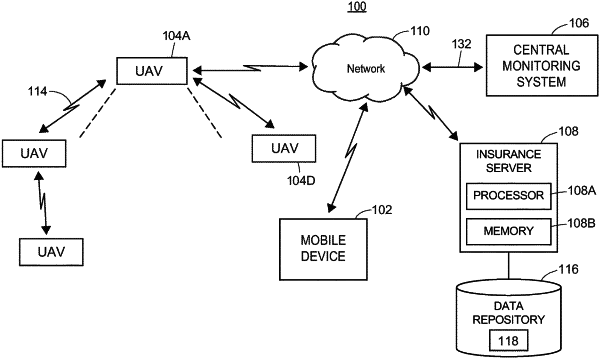
1. A computer-implemented method of directing an unmanned aerial vehicle for inspecting a property, the method comprising:
receiving, by one or more processors, a location for an inspection of a property to be conducted by an unmanned aerial vehicle (UAV);
determining, by the one or more processors, a geofence boundary based on an area corresponding to a property boundary;
determining, by the one or more processors, a navigation route corresponding to the geofence boundary for inspection of the property by the UAV;
sending control signals, by the one or more processors to the UAV, to direct the UAV to capture drone data along the navigation route.