| CPC B63B 49/00 (2013.01) [B63H 25/04 (2013.01); B63H 25/42 (2013.01); G01C 13/008 (2013.01); G05D 1/0206 (2013.01); G08G 3/02 (2013.01); B63H 2025/045 (2013.01)] | 10 Claims |

|
1. A method of controlling a marine vessel, comprising:
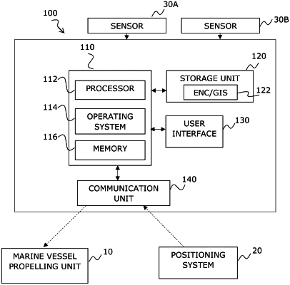
receiving, by a controller, a position of the marine vessel from a positioning system;
receiving, by the controller, geographical data, from at least one database, the geographical data comprising at least a map of obstacles;
receiving, by the controller, a heading direction and speed of the marine vessel;
calculating an expected time for running aground of the marine vessel, by calculating two decelerations, a first deceleration from a current cruising speed to a disengagement speed and a second deceleration from the disengagement speed to zero speed, wherein the disengagement speed is the speed at which an engine of the marine vessel can engage or disengage with a propelling unit of the marine vessel;
determining, by the controller, a safety zone ahead of the marine vessel based on the expected time for running aground, the position, the heading direction and the cruising speed of the marine vessel;
identifying, by the controller, a location of an obstacle inside the safety zone based on the received geographical data; and
changing, by the controller, a state of the propelling unit of the marine vessel when a critical obstacle was identified inside the safety zone, wherein changing the state of the propelling unit of the marine vessel comprises disengaging the engine of the marine vessel from the propelling unit.
|