| CPC H04B 17/391 (2015.01) [H04B 17/23 (2015.01); H04B 17/345 (2015.01); H04W 24/10 (2013.01)] | 20 Claims |
|
1. A method comprising:
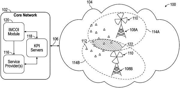
receiving inputs that include geo-located data collected over a period for a plurality of cells in a radio access network (RAN);
mapping the geo-located data to one or more interference polygons displayed through a graphical user interface (GUI) on a user interface (UI), the interference polygons being layered above a display of a geo-location;
determining a dataset of each cell included in each interference polygon displayed through the GUI;
determining a total number of user samples included in each interference polygon;
determining a number of user samples for each cell included in each interference polygon;
in response to a first cell including less than or equal to a first threshold of the total number of user samples, determining whether the first cell is an over-shooter cell; and
in response to the first cell including greater than the first threshold of the total number of user samples, determining whether the first cell is misaligned.
|