| CPC G01C 21/203 (2013.01) [B60L 50/60 (2019.02); B60L 58/12 (2019.02); B63B 49/00 (2013.01); B63B 79/40 (2020.01); B60L 8/003 (2013.01); B60L 15/2045 (2013.01); B60L 2200/32 (2013.01); B60L 2240/12 (2013.01); B60L 2240/62 (2013.01); B60L 2240/66 (2013.01); B60L 2250/10 (2013.01); B60L 2250/16 (2013.01); B60L 2260/52 (2013.01); B60L 2260/54 (2013.01)] | 20 Claims |

|
1. A method comprising:
receiving propulsion mode data as user input provided to a user interface, the propulsion mode data specifying user selection for at least one of:
(i) power to be used for at least one propulsion power source relative to a full power of the at least one propulsion power source;
(ii) whether to use at least one generator of power provided to at least one motor for propulsion;
(iii) whether to use one or more specific propulsion power sources;
(iv) amount of draw of accessory power from a power source supplying both accessory power and propulsion power;
determining an operational state of a mobile structure based, at least in part, on operational state data provided by at least one operational state sensor mounted to or within the mobile structure;
determining environmental conditions associated with the mobile structure; and
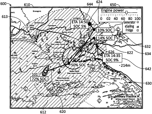
determining an operational range map associated with the mobile structure based, at least in part, on the propulsion mode data, the operational state of the mobile structure and the environmental conditions associated with the mobile structure, wherein determining the operational range map comprises determining a set of straight line range estimations from an initiation position of the mobile structure provided by the position sensor;
wherein each straight line range estimation is based, at least in part, on a series of predicted speeds of the mobile structure along each straight line range estimation; and
wherein each predicted speed is based, at least in part, on the operational state of the mobile structure and a true or apparent wind polar associated with the mobile structure.
|