| CPC G06T 7/579 (2017.01) [G01S 17/894 (2020.01); G01S 17/931 (2020.01); G06T 2207/10028 (2013.01)] | 20 Claims |
|
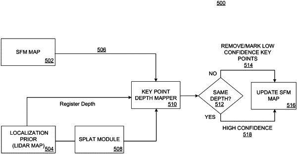
1. A method of validating triangulated points in a digital image, the method comprising,
receiving a motion-generated image corresponding to the digital image;
generating a first depth map, wherein the first depth map comprises first depth information for one or more triangulated points located within the motion-generated image;
receiving a light detection and ranging (lidar) generated point cloud comprising a portion of the one or more triangulated points;
splatting the lidar generated point cloud proximate to the portion of the one or more triangulated points to generate a splatted point cloud;
generating a second depth map for at least the portion of the one or more triangulated points, wherein the second depth map comprises second depth information for the portion of the one or more triangulated points located within the splatted point cloud; and
validating a triangulated point, of the portion of one or more triangulated points, based on comparing the first depth information to the second depth information.
|