| CPC G06Q 10/06395 (2013.01) [G06Q 50/26 (2013.01); G06V 20/56 (2022.01); H04W 4/029 (2018.02); H04W 4/40 (2018.02)] | 10 Claims |
|
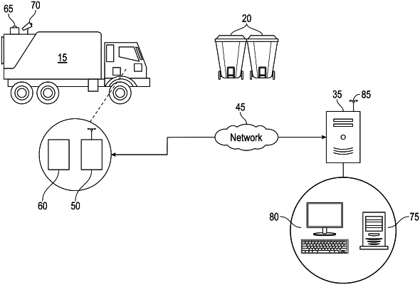
1. A method of analyzing service route data for a waste or recycling service vehicle on a service route, the method comprising:
collecting location information for the vehicle as the vehicle travels along the service route, wherein the location information is collected using a locating device capable of satellite communications associated with the vehicle;
identifying a vehicle stop point from the collected location information to determine whether the vehicle is providing collection services at the vehicle stop point, wherein the vehicle stop point for a residential stop comprises an exact vehicle stop point identified by determining that latitude and longitude location information is the same for two consecutive-in-time communications from the locating device, and wherein the vehicle stop point for a commercial stop comprises an interpolated vehicle stop point identified by determining that the calculated speed of the vehicle between two consecutive-in-time communications from the locating device is less than a predetermined value;
associating the vehicle stop point to a parcel to determine the street address;
determining whether the vehicle is providing collection services to a street address associated with the vehicle stop point;
associating the street address with stored customer related contract and stored customer information;
displaying, on an electronic viewing portal, the street address and an image captured by an optical sensor on the vehicle at the vehicle stop point; and
making the electronic viewing portal available for viewing by a user to confirm whether the street address is associated with the stored customer information.
|