| CPC G05D 1/106 (2019.05) [B64D 47/08 (2013.01); G01C 11/06 (2013.01); G01C 21/32 (2013.01); G01C 21/3852 (2020.08); G06V 20/17 (2022.01); B64U 10/25 (2023.01); B64U 2101/30 (2023.01); B64U 2201/10 (2023.01); B64U 2201/20 (2023.01)] | 20 Claims |
|
1. A computer-implemented method comprising:
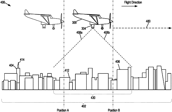
during a flight to a destination by an unmanned aerial vehicle (UAV), operating an image capture device coupled to the UAV to capture a first image of an environment;
identifying, based on the first image, a first visual feature within the environment;
determining a current location of the UAV by determining a relationship between the first visual feature and a first map feature of a map;
comparing the current location of the UAV to location data from a primary navigation system of the UAV;
based on comparing the current location to the location data from the primary navigation system, determining a discrepancy between the current location and the location data from the primary navigation system; and
based on determining the discrepancy, outputting an alert indicative of the discrepancy.
|