| CPC G01V 20/00 (2024.01) [G01V 1/282 (2013.01)] | 20 Claims |
|
1. An apparatus that comprises a non-transitory, computer-readable storage medium that comprises instructions that, when executed by at least one processor, cause the at least one processor to perform operations comprising:
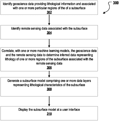
identifying geoscience data associated with one or more particular regions of a subsurface, the geoscience data comprising information associated with the lithology of the one or more particular regions of the subsurface;
identifying remote sensing data associated with the subsurface;
correlating the geoscience data with the remote sensing data using at least one machine learning model to determine inferred data representing lithology of one or more regions of the subsurface associated with the remote sensing data where geoscience data is unavailable;
generating an at least partially global subsurface model of the subsurface comprising one or more data layers, each data layer representing at least one geological characteristic of the subsurface, wherein the at least partially global subsurface model comprises a repository of data layers arranged in a hierarchy, comprising at least one of: (1) publicly shared user data layers, (2) private user data layers, or (3) historical data layers; and
generating a graphical representation of the at least partially global subsurface model for display at a user interface.
|