| CPC G01C 21/3841 (2020.08) [G01C 21/3807 (2020.08); G01C 21/3848 (2020.08); G01C 21/3867 (2020.08)] | 11 Claims |
|
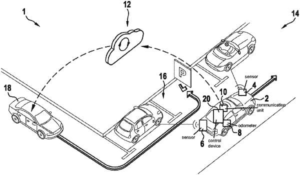
1. A method for creating a map of at least one parking infrastructure by a server unit, unoccupied parking spaces inside the parking infrastructure being registered, the method comprising the following steps:
receiving, by the server unit, items of path information and items of environmental information ascertained by a vehicle sensor system of at least one vehicle about a path of the at least one vehicle;
subdividing the path information into path segments;
rectifying, by the external server unit, the path segments to compensate errors, and using the rectified path segments to create or update a geometrical map of the parking infrastructure; and
based on the items of environmental information and based on the rectified path segments, acquiring occupied and unoccupied parking spaces along the path of the at least one vehicle to ascertain unoccupied parking spaces inside the parking infrastructure,
wherein the rectified path segments are combined to form loops, wherein each loop of the loops form a vertical level of the parking infrastructure, wherein changes of a parking space level are determined based on the ascertained occupied and unoccupied parking spaces along the path of the at least one vehicle, and being taken into account in the creation or updating of the map, and wherein changes of a level in the environmental information are determined.
|