| CPC A62C 3/0271 (2013.01) [G01W 1/10 (2013.01); G06F 16/587 (2019.01); G06F 16/9038 (2019.01); G06N 20/10 (2019.01); G08B 17/005 (2013.01)] | 20 Claims |
|
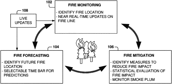
1. A method comprising:
accessing, by a computer system, a database to obtain values for a plurality of features associated with a fire in a geographical region, the plurality of features comprising one or more satellite images at a first resolution, each satellite image comprising a plurality of first cells associated with the geographical region, the first resolution defining a first size of each first cell;
generating a map of the geographical region, the map comprising a plurality of second cells having a second size, the second size being smaller than the first size, the map of the geographical region having a higher resolution than a resolution of the one or more satellite images;
estimating, using a machine-learning model, probability values for the second cells in the map based on the plurality of features, each probability value indicating if the second cell contains an active fire;
updating the map of the geographical region based on the probability values for the second cells; and
causing presentation of the map in a user interface.
|