| CPC G01S 5/0284 (2013.01) [G01S 19/47 (2013.01); H04B 7/18506 (2013.01); H04W 4/023 (2013.01); H04W 76/10 (2018.02)] | 15 Claims |
|
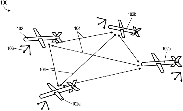
1. A first mobile node of a network of N mutually connected mobile nodes, where N is an integer not less than four, the mobile node comprising:
one or more positional sensors selected from a group including:
a barometric altimeter configured to determine pressure altitude data corresponding to the first mobile node;
an absolute position receiver configured to determine absolute position data of the first mobile node based on one or more received positioning signals;
and
an inertial measurement unit (IMU) configured to determine first inertial data of the first mobile node, the first inertial data associated with a platform reference frame;
at least one network radio configured to establish a data link to each neighbor node of the N mobile nodes;
and
one or more processors coupled to the one or more positional sensors and to the at least one network radio, the one or more processors configured to:
receive, from the one or more positional sensors, at least one of the first inertial data and the pressure altitude data;
determine, via the network radio, at least one first ranging between the first mobile node and each neighbor node;
receive, via the network radio and the data link:
second inertial data and remote altitude data from each neighbor node;
and
at least one second ranging corresponding to each unique pair of neighbor nodes;
and
generate at least one relative position, navigation and timing (PNT) solution relative to the platform reference frame, the relative PNT solution associated with the absolute position data, the relative PNT solution based on:
the first inertial data and the pressure altitude data of the first mobile node;
and
the second inertial data and the remote altitude data of each neighbor node.
|