| CPC G08G 1/141 (2013.01) [B60Q 9/004 (2013.01); G06V 20/586 (2022.01); G08G 1/01 (2013.01); G08G 1/0112 (2013.01); G08G 1/0129 (2013.01); G08G 1/0141 (2013.01); G08G 1/14 (2013.01); G08G 1/143 (2013.01); G08G 1/147 (2013.01)] | 29 Claims |

|
1. A system comprising:
a sensor circuit mountable to a vehicle, the sensor circuit comprising:
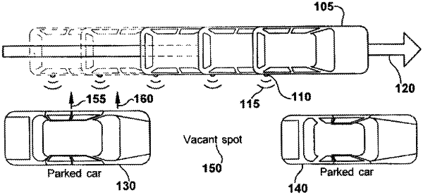
one or more sensors that are configured to generate sensor information as the vehicle moves along a path, the sensor information indicating one or more spatial changes to regions laterally adjacent the vehicle and including sensed data usable to determine at least a first dimension of the one or more spatial changes; and
one or more processors configured to:
determine at least a second dimension of the one or more spatial changes based on a plurality of consecutive instances of sensed data gathered while the vehicle moves along the path, wherein the second dimension includes width of a first spatial change across the consecutive instances, determined at least in part based on a sampling rate associated with the sensor information and a speed of the vehicle;
translate the sensor information into detailed parking information showing parking availability for at least portions of the path based on the determined first and second dimensions; and
provide the parking information to one or more vehicles for visual output.
|