| CPC A01B 79/005 (2013.01) [G01C 15/002 (2013.01); G01C 15/06 (2013.01); G01S 17/89 (2013.01); G06T 7/10 (2017.01); H04N 23/531 (2023.01); G06T 2207/10024 (2013.01); G06T 2207/10028 (2013.01); G06T 2207/30188 (2013.01)] | 21 Claims |
|
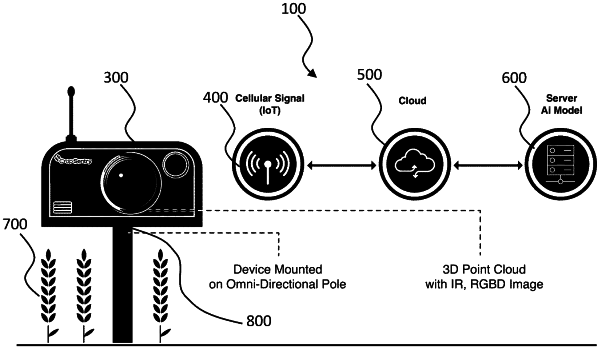
1. A crop monitoring system for a field comprising:
a frame;
a battery mounted to the frame and providing electrical power;
a Light Detection and Ranging (LiDAR) sensor mounted to the frame;
a camera mounted to the frame;
an enclosure mounted to the frame, the enclosure housing a processing structure; the processing structure executing a plurality of instructions stored on a tangible computer-readable memory;
the instructions comprise:
capturing point data from the LiDAR sensor;
capturing image data from the camera;
generating a 3D color-assigned cloud point data set from the image data and the point data; and
determining crop characteristic data based on the 3D color-assigned cloud point data set.
|