| CPC G06T 7/521 (2017.01) [G06N 20/00 (2019.01); G06T 17/10 (2013.01); G06V 10/25 (2022.01)] | 20 Claims |

|
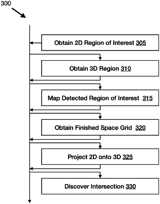
1. A method of detecting a region of interest in an image of a space, the method comprising:
obtaining a plurality of depth measurements captured by a depth sensor attached to a device, the plurality of depth measurements defining distances from the depth sensor to respective points in the space using a three dimensional grid;
declaring those depth measurements a portion of the space;
obtaining a detected region of interest in the image of the portion of the space, captured by a machine learning recognition system using two dimensions of the three dimensional grid;
mapping the detected region of interest onto the three dimensional grid in two dimensions to make a two dimensional detected region of interest;
obtaining a finished depth measurement three dimensional grid of the space;
projecting the detected region of interest onto the finished depth measurement three dimensional grid of the space to make a projected three dimensional shape;
discovering an intersection between the projected three dimensional shape and the finished depth measurement three dimensional grid of the space as a region of interest; and
generating a floor plan of the space including a representation based on the detected region of interest and the discovered intersection.
|