| CPC G01C 21/1656 (2020.08) [G01C 21/30 (2013.01); G01C 21/3647 (2013.01)] | 20 Claims |

|
1. A method comprising:
receiving orientation data from an orientation sensor coupled to a mobile structure; and
performing a stabilization of the imaging system, wherein performing the stabilization comprises:
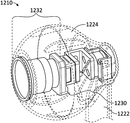
determining a boresight roll of an imaging module of an imaging system coupled to the mobile structure based, at least in part, on the received orientation data, wherein the imaging module is disposed within a sealed enclosure and configured to capture image data along an optical axis of the imaging system according to a field of view (FOV) of the imaging module;
controlling a mechanical roll stabilizer of the imaging system coupled to the imaging module to compensate for the determined boresight roll, wherein the mechanical roll stabilizer is disposed within the sealed enclosure and is configured to provide mechanical roll stabilization of the imaging module with respect to the optical axis of the imaging system; and
performing an electronic stabilization of at least one of a pitch and/or yaw of the imaging module.
|