| CPC H04N 7/188 (2013.01) [G01C 21/3811 (2020.08); G01C 21/3867 (2020.08); G07C 5/08 (2013.01); H04N 23/80 (2023.01); G09B 29/007 (2013.01)] | 6 Claims |
|
1. A vehicle electronic device comprising:
a position information acquisition unit configured to acquire position information of a current position of a vehicle;
a map information storage unit configured to store map information presenting a map for identifying an area corresponding to the current position of the vehicle on the map; and
an area identification unit configured to identify the area corresponding to the current position of the vehicle based on the position information acquired by the position information acquisition unit and the map information stored in the map information storage unit,
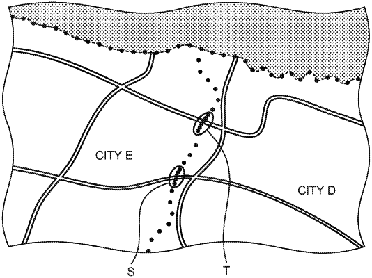
wherein the map information is information for identifying a border of an area containing a country, a prefecture, a municipality, a state or a district,
wherein the border of the area is defined by a border line comprising a set of points that extend linearly along a length of the border and have a non-constant density of spacing of the points relative to one another, and
wherein in the map information, at a location where the border line overlaps a road, the border line has a first density of the spacing of the points, and at a location where the border line is spaced from the road, the border line has a second density of the spacing of the points that is less than the first density.
|