| CPC G01V 99/005 (2013.01) [G01V 1/003 (2013.01); G01V 1/282 (2013.01); G06F 30/20 (2020.01); E21B 49/00 (2013.01); G01V 2210/642 (2013.01); G01V 2210/643 (2013.01); G01V 2210/66 (2013.01); G01V 2210/661 (2013.01); G06F 17/00 (2013.01)] | 20 Claims |

|
1. A method comprising:
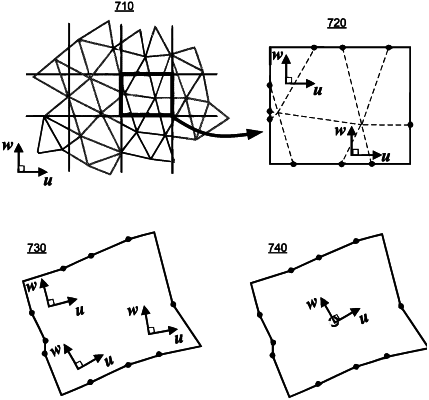
accessing a depogrid generated via gridding of a structural model in a depositional space and transforming the gridded structural model to a geological space via an inverse mapping wherein the structural model represents structural features in a subterranean environment based at least in part on data acquired via at least one sensor;
determining local u, v and w axes for a plurality of cells in the depogrid via volumetric centroids and vertices of each of the plurality of cells as represented by coordinates in a depositional space coordinate system (u, v, w) and by coordinates in a physical coordinate system (x, y, z);
orthonormalizing the local u, v and w axes for the plurality of cells to generate orthonormalized local u, v and w axes for the plurality of cells, wherein an increased local amount of orthonormalization indicates a decreased local quality due to locally inconsistent interpretation of one or more of the structural features represented in the structural model;
defining directional geological grid properties based at least in part on the orthonormalized local u, v and w axes, wherein the directional geological grid properties comprise a tensor permeability property; and
simulating fluid dynamics of the subterranean environment to generate simulation results via a simulator based at least in part on at least a portion of the directional geological grid properties as assigned to the depogrid.
|