| CPC G01C 21/3407 (2013.01) [B60W 60/001 (2020.02); G01C 21/3453 (2013.01)] | 16 Claims |
|
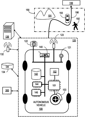
1. A method comprising:
obtaining, using at least one processor, a spatial structure comprising a plurality of nodes connected by edges, wherein at least some of the nodes and edges represent a path to navigate a vehicle from a first point to a second point;
labeling, using the at least one processor, edges of the spatial structure as useful, based on, at least in part, a measure of how closely an edge replicates driving data samples from drive logs, wherein an edge is useful when a number of times the edge is found in the driving data samples satisfies a threshold and a sequence of edges is useful when a distance between the sequence of edges and the driving data samples satisfies a predetermined threshold;
pruning, using the at least one processor, the spatial structure by removing at least one edge from the spatial structure according to respective labels of the edges, wherein an extent of the removal is based on a predetermined graph size, a predetermined performance, or any combinations thereof to obtain a pruned graph;
adjusting the extent of the removal of the at least one edge from the spatial structure according to a measure of a coverage of paths in the drive logs by paths recreated on the pruned graph; and
navigating, using the at least one processor, the vehicle in accordance with a path from a first point to a second point representing a useful sequence of edges on the pruned graph.
|