| CPC A01G 2/00 (2018.02) [A01G 7/00 (2013.01); G06F 16/5838 (2019.01); G06F 16/5866 (2019.01); G06F 16/587 (2019.01); G06T 7/001 (2013.01); G06V 20/56 (2022.01); H04N 7/185 (2013.01); A01B 79/005 (2013.01); G06T 2207/30128 (2013.01); G06T 2207/30188 (2013.01); G06V 20/68 (2022.01)] | 26 Claims |

|
1. A system for adjusting settings of a field apparatus during a pass through an agricultural field, the system comprising:
one or more processors;
one or more non-transitory computer-readable storage media storing instructions which, when executed by the one or more processors, cause the one or more processors to perform operations comprising:
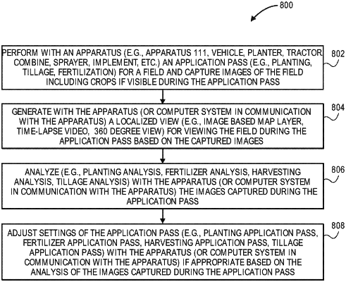
capturing a plurality of digital images of a portion of the agricultural field during the pass of the agricultural field by the field apparatus, the plurality of digital images captured by a mobile image capture device and the pass including a planting application pass through the agricultural field, and a tillage application pass through the agricultural field;
generating a localized view map of the agricultural field based at least in part on the plurality of digital images for viewing the agricultural field during the pass;
performing an image analysis, wherein the image analysis comprises analyzing the plurality of digital images to determine at least one condition of the agricultural field, the at least one condition of the agricultural field including a soil moisture condition of the agricultural field;
performing a tillage analysis during the tillage application pass, wherein the tillage analysis further comprises a soil residue analysis after the planting application pass; and
adjusting one or more settings of the field apparatus during the pass of the agricultural field, based on the image analysis of the plurality of digital images and the tillage analysis, the one or more settings including a speed and/or a downforce of the field apparatus.
|