| CPC G06T 7/80 (2017.01) [B60W 40/04 (2013.01); G06V 10/40 (2022.01); B60W 2420/403 (2013.01); G06T 2207/30252 (2013.01)] | 20 Claims |
|
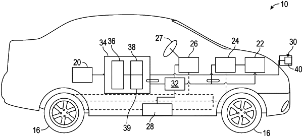
1. A method of navigating a vehicle, comprising:
obtaining an original image data file of an environment at a camera conveyed by the vehicle;
reducing the original image data file to obtain a reduced image data file;
determining an alignment between a camera-centered coordinate system and a ground coordinate system using the reduced image data file; and
determining a weighted average value of the alignment using a confidence level of a moving average of the alignment for a plurality of frames of the reduced image data file.
|